There are countless places to discover and activities to do in the mountains we have a few kilometers from Villar de Huergo. Some of the recommendations are:
Sierra del Sueve
It is truly wonderful. It is a coastal mountain range, whose highest peak, the peak Pienzu reaches 1161mts. You can make excursions of varying difficulty, but all of incredible scenic beauty, as you can see both the Cantabrian coast, a few kilometers from the top, and the peaks of Europe on the opposite side. The Mirador del Fito, is one of the most famous hills and is accessible by vehicle (it is also the starting point for various trekking routes).
Espinaredo y la Pesanca
The village of Espinaredo is a nice and cozy Asturian village, people say it is the village with more and best preserved Asturian granaries, as they date from the seventeenth and eighteenth centuries. There are more than 30. You can make excursions around or go by car on the track that runs along the river Infierno until the area called La Pesanca, a forest ideal for walking on a rainy afternoon, and keep walking until Foces del Rio.
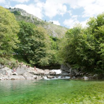
La Olla de San Vicente
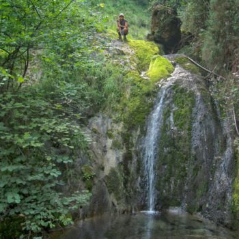
It is a natural pool formed by the Dobra River, which is famous for waters of emerald green colour, with a depth that reaches five meters. The Dobra River is one of the most vertical of the Asturian geography. It originates and the Leon side of the Picos de Europa and ends its route giving its waters to the Sella river. It’s only at 6 km from Cangas de Onis, the way to get to the pool is nice and easy to do. Just two hundred meters after the start, you can see the stone bridge known as the Puente Viejo (Old Bridge) whose origin is uncertain, although it seems medieval due to its characteristics. Following up the river, after 30 or 40 minutes, you will reach the Olla, of great beauty. An ideal route to do with children.
Picos de Europa
There are a multitude of excursions to do in the Natural Park of the Picos de Europa. It has an incredible scenery and beautiful corners, which is why it’s the second most visited in Spain after the Natural Park of Teide.
Santuario de Covadonga
It is one of the main sites of Christian pilgrimage, built in the late nineteenth century with a Romanesque style, and the crypt is located inside. In the eighth century, this place was the scene of confrontation in which a group of mountaineers led by Don Pelayo defeated the Muslim troops, thus initiating the Reconquista. In the holy cave the Patroness of Asturias, the Santina, is worshiped. In the cave you can also find the tombs of King Pelayo, his wife, his sister and Alfonso I.
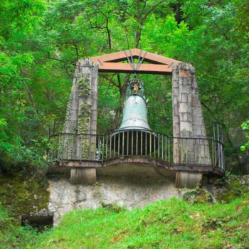
La campanona
Located in the tunnel that leads to the holy cave, this impressive bell of 4,000 kilos measures three meters and was built in 1900, taking the first prize and the gold medal of the Universal Exhibition in Paris, held a year later.
Lagos de Covadonga
More than 1000 meters high, the lakes of Covadonga are formed by two small lakes, Enol and Ercina of glacial origin. A third lake, Bricial, only has water during the thaw. In Asturias they are known simply as the lakes.
La Garganta del Cares
The route of this gorge, called by many authors La Garganta Divina, allows us to unite Asturias with Leon through the depths of the Picos de Europa whose peaks stare at us from more than 2,000 meters above and enjoying the beautiful views that offer us the crystal waters of the river Cares and the channels that plunge precipitously from the heights to its waters.
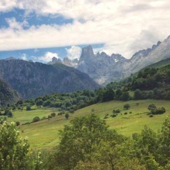
Bulnes
It is the most famous and emblematic village of the Picos de Europa. Without accessing roads, it is enclosed in the midst of breathtaking mountains. By walking 15 minutes we will have stunning views of Pico Urriellu (Naranjo de Bulnes). To go up to the village of Bulnes we can use the cogwheel train or walk up the Canal del Tejo. It is a nice tour of an acceptable slope (400-500 m), by nice routes and able to make with children.
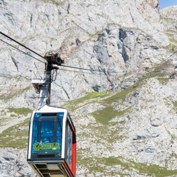
Telesferico de FuenteDe
It is in the heart of the Picos de Europa, just a few kilometers away from Santo Toribio de Liebana and from Potes. There’s an unevenness of 754 meters high so when we are at the bottom, we are at a height of about 1100 meters and when reaching the top, we’ll be at almost 1900. There is no attachment between these two points, only two cables by the cable car glides . At the upper end of the cable car there’s the lookout, not suitable for those with vertigo, because it stands out and is suspended at a great height. From there a few hiking trails start.


